In California, rice fields serve as "surrogate wetlands" for waterfowl and other wildlife. Cereal grain field, such as winter wheat and triticale, can play an equally important role as "surrogate uplands" where duck and ground-nesting birds can build nests safely hidden from predators in the dense vegetation.
Cereal grains are incredibly attractive to nesting ducks. Most grains fields are seeded in the fall and grow throughout the winter. By nesting season, a lush, dense stand of cereal grains exists and, when planted near rice fields or other water sources, can provide excellent "surrogate upland" nesting habitat. In fact, several studies have found ducks may favor nesting in winter wheat over natural uplands when they're available. Furthermore, studies have shown that winter wheat in rice country can produce far higher mallard nest densities and nest survival than anything in the Prairie Pothole Region.
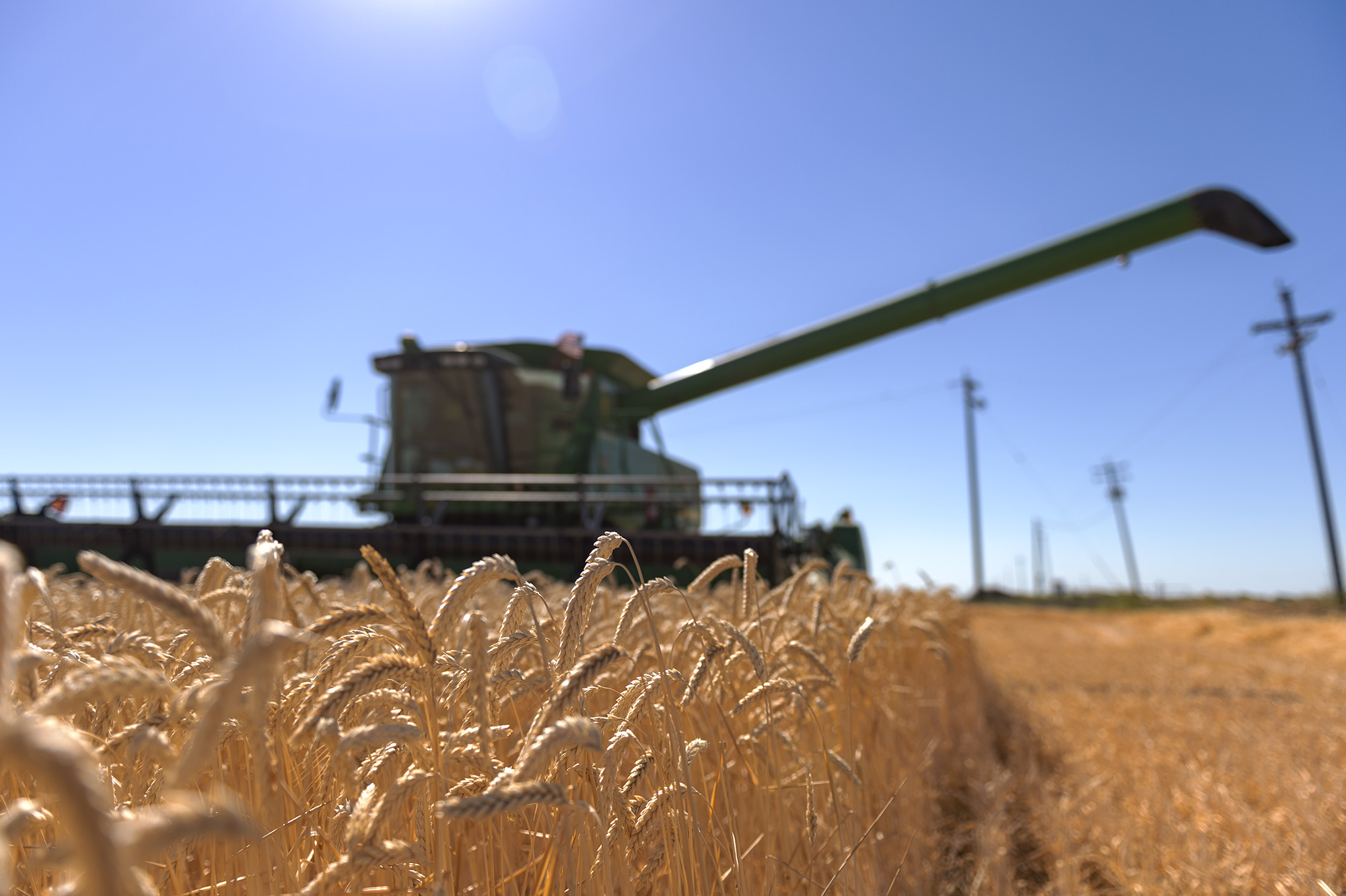
Unfortunately, wheat acreage has declined in California and so has the Sacramento Valley's once robust mallard and pheasant populations. Furthermore, the minimal acreage of cereal grains still present in the Central Valley is typically harvested between late May and early June, often before the majority of nests are hatched. This results in complete loss of the nest and can result in mortality of the hen as well. While we cannot stop the market forces that are reducing cereal grain production, we can work to make the remaining fields as productive as possible for ground nesting birds.
PROGRAM REQUIREMENTS:
The Delayed Cereal Grain Harvest program provides an incentive to farmers that are willing to delay the harvest of their grain fields until at least July 15th, which allows ground nesting birds to hatch and exit the field before harvest occurs. The incentive offsets costs associated with the increased risk of fire hazards and yield losses from delaying harvest. Farmers are some of the best waterfowl conservationists in the state, and we're excited to provide them with an opportunity to help boost our local mallard and pheasant populations.
Where delayed harvest is not possible, California Waterfowl operates an Egg Salvage Program in cooperation with farmers to rescue nests prior to harvest or field work in agricultural fields. Nests are located and delivered to a licensed hatchery where eggs are incubated, and ducklings reared for five weeks with minimal human interaction before being released into the wild.
Incentive Rate and Funding:
-
- There will be $100,000 available for this program in the 2025 nesting season.
- Payment rates will vary based the amount of monitoring that is allowed within the field. Applicants will only be awarded the higher incentive rates if they allow additional monitoring and are selected.
- Standard: The incentive rate is $50/acre. Biologist will not enter grain fields and will only monitor bird activity from the levees or roads.
- Monitoring A: The incentive rate is $65/acre. Biologists will conduct nest searching in the grain fields with two people pulling a rope through the field on foot.
- Monitoring B: The incentive rate is $75/acre. Biologists will conduct nest searching in the grain fields with two people pulling a rope through the field on ATVs.
- Payments will be made shortly after July 15th if program all requirements are met.
Program Area:
-
- Enrollment for this program is constrained to the Central Valley and the associated
planning regions, as designated by the Central Valley Joint Venture.
- Enrollment for this program is constrained to the Central Valley and the associated
Eligible Applications:
-
- Cereal Grain Crops such as (Wheat, Triticale, Oat, Barley and Rye)
- 20 acre minimum
- Crop must cover at least 75% of the field and the average height must be at least 8 inches tall.
- Summer water must be located within 1 mile of upland
Ineligible Applications:
-
- Cereal grain fields without reliable summer water within 1 mile
- Cereal grain fields that will be harvested before July 15
RANKING AND SELECTION:
Applications will be reviewed by a selection committee that is made up of biologists from WA and representatives from each of the following Department Programs: Waterfowl, Upland and Small Game, Wetland Conservation Program, and the Nesting Bird Habitat Incentive Program. After the solicitation closes, Ail applications will be evaluated and scored based on the following ranking categories:
| Ranking and Scoring Delayed Cereal Grain Harvest Program |
Max Points 60 |
|
1. Proximate Water Sources within 1/2 mile of field (Include all that apply). 8 pt = Managed Summer Wetland |
17 |
|
2. Condition of Cereal Grains – Percent Cover. 8 pt = 100% cover |
8 |
|
3. Condition of Cereal Grains – Vegetation Height. 8 pt = Over 24 inches |
8 |
|
4. Size of Field 6 pt = 100 or more acres |
6 |
|
5. Continuity and Edge Impacts 4 pt = Low perimeter/area ratio |
4 |
|
6. Other Qualities and Conservation. 3 pt = The property has successfully participated in NBHIP or other Conservation Programs |
3 |
|
7. Participation in Monitoring 4 pt = Landowner will allow ATV Searching in the field |
4 |
|
8. Proximity to State Wildlife Areas and National Wildlife Refuges. 5 pt = Protected area within 0 - 1 miles |
5 |
|
9. Proximity to protected Private Lands (Presley Program or Conservation Easements) 5 pt = Protected area within 0 - 1 miles |
5 |
Want to participate?
Applications for this program ran from February 15 – March 29, 2026 and are now closed. Check back next year for the next round of applications.
If you have questions, please contact Jason Coslovich at (408)644-3525 or jcoslovich@calwaterfowl.org.


